Climate change is shaping the Earth in new and often devastating ways as the planet heats up more rapidly than ever. For animals, warming temperatures mean they’ll be forced to find new homes as their current habitats become unlivable.
But these mass movements can be hard to visualize — that is, until you’ve seen this incredible map outlining likely migration paths for close to 3,000 species of mammals, birds, and amphibians in North and South America.
Researchers from The Nature Conservancy plotted the routes of each species using climate projections and movement models from a couple of studies published in 2013 and 2016. The animated map shows how the animals will travel north and away from the equator, while avoiding significant obstacles caused by human development, such as highways, agricultural farms and urban infrastructure.

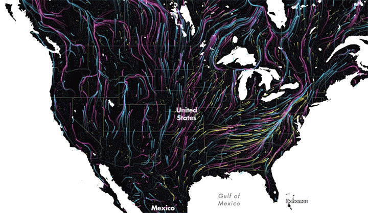
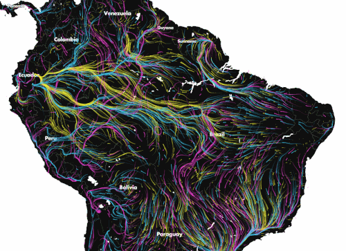
Mammals are represented on the map by pink arrows, while birds are blue and amphibians are yellow.
As the animations show, hundreds of species will likely converge on a few key spots as they make their way to greener pastures. These pathways suggest there is still hope for animals to find new habitats and survive, despite the unprecedented challenges they face from manmade barriers.
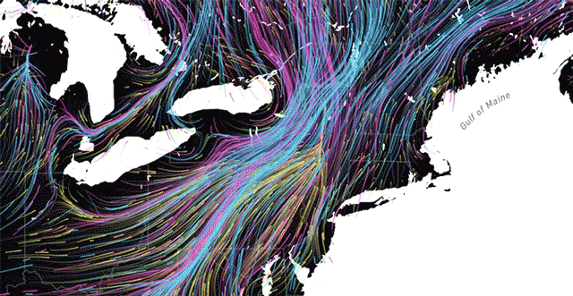
In the United States, for example, the Appalachian Mountains on the East Coast will serve as an important natural pathway for species migrating north.
Unlike the West, where animals can move uphill more easily, the Appalachians provide one of the few places of refuge for most of the animals located in surrounding areas. One of the studies that inspired the map found that just 2 percent of natural lands in the eastern part of the country have the connectivity required for animals to migrate.
“Much of the land outside of the mountain range is developed or in agriculture,” Brad McRae, who co-authored the studies, told City Labs. “So as species ranges shift north, the Appalachians are providing some of the least-developed routes for movement. They also provide some climate relief due to their high elevation.”
In South America, the map shows a ton of climate-driven migration along the Amazon basin and in Southern Brazil.
The research and the map highlight the need for preserving or restoring “wildlife corridors” — natural stretches of land that remain unobstructed by human development so wildlife can travel freely in search of new homes.
“Increasing connectivity between natural areas really does improve plants’ and animals’ ability to track their current climate,” Jenny McGuire, an ecologist at Georgia Tech told Climate Central.
As it stands, the map provides only a large-scale view of how animals will migrate, but the data does not provide detail on individual animals or the local routes they’ll take. The study’s authors hope to do more research to determine what areas are most in need of protection.


